


Have you ever driven down a road and observed people walking in straight lines, wearing safety vests, and carrying pin flags? If so, they may have been archaeologists conducting a survey. If not, clearly you are missing out on some fascinating roadside attractions.
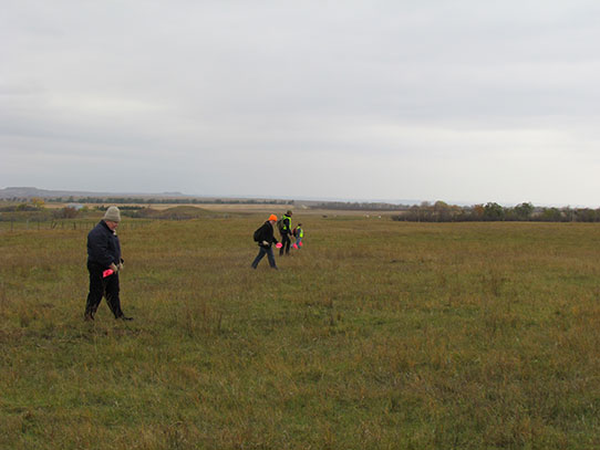
Archaeologists conducting a survey in Burleigh County, North Dakota.
The purpose of an archaeological survey is to walk over a defined area looking for artifacts and archaeological features. Common artifact types we find include: projectile points (arrowheads), chipped stone flakes, ceramics, and animal bone. Man-made features we find may include: earthworks, stone features, and depressions. Artifacts and features that we identify during a survey are recorded as archaeological sites.
In September, a local landowner donated rare, well-preserved artifacts found on his farmstead over the last 60+ years. The artifacts date to the Paleoindian (9500-5500 BC), Early Plains Archaic (5500-2800 BC), Middle Plains Archaic (2800-1000 BC), Late Plains Archaic (1000-400 BC), and Plains Woodland (400 BC-1200 AD) time periods. In October, the landowner generously allowed archaeologists and a volunteer from our Archaeology and Historic Preservation Division to conduct a survey on his property to look for more archaeological sites.
The day of survey was a little chilly and windy (surprise!). Five of us walked over pasture and a plowed field. The south end of the project area was bounded by a small stream and the north by a fence and transmission line. We walked lines paralleling one another, spaced about 50 feet apart. The pasture had been grazed so the grass was short, making it much easier for us to see the ground surface.
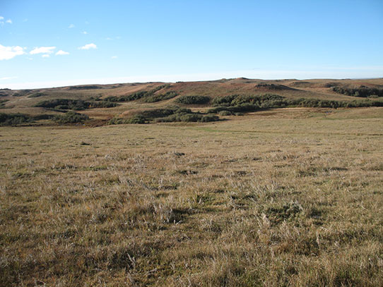
Pasture land, view to south from the middle of the survey area.
Visibility in the plowed field was not as good because of trampled crop stubble.
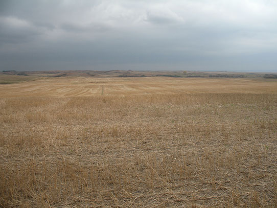
A portion of the plowed field, view to south.
We were able to inspect areas where there was bare ground or eroded slopes more closely.
So, what did we find? We recorded three different locations. In each location we found a chipped stone flake (fakes are created during production or use of a stone tool).
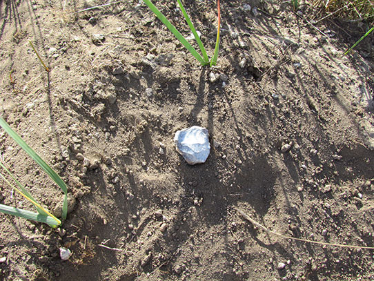
An isolated artifact (flake tool) found and recorded during survey.
The flakes consisted of two pieces of Knife River flint and one piece of Tongue River Silicified Sediment. Three artifacts may not seem too exciting, but half of the fun is the anticipation that you might find something!
Regardless of the October survey results, we would like to return next year. Why? Based on our archaeological knowledge of the area, the environmental setting indicates high potential for prehistoric and historic archaeological sites. The landowner’s oral history of his farmstead provides information about local settlement and use of the land, which also suggests sites may be found here. We only surveyed a portion of the farmstead so there is plenty more to walk. Some test excavations would be necessary to record artifacts and features beneath the ground surface.
A flower photographed by Meagan during survey.