Backstage Pass to North Dakota History

This blog takes you behind the scenes of the State Historical Society of North Dakota. Get a glimpse at a day-in-the-life of the staff, volunteers, and partners who make it all possible. Discover what it takes to preserve North Dakota's natural and cultural history.

Archaeology is Elemental: Geochemical Source Analysis of Obsidian Artifacts from North Dakota

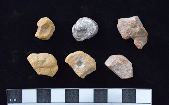
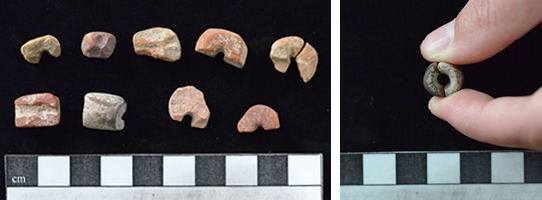
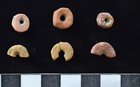
Lithics, or stone tools and flaking debris, are among the most common artifacts found at archaeological sites in North Dakota. They can convey information to archaeologists about the people who made these objects, and they can also tell a much larger story of landscape use and cultural interaction. The rocks people eventually knapped into tools had to first be collected—sometimes this was done directly by the knappers themselves, and sometimes stone was acquired through trade with other groups of people. Lithic materials from North Dakota sites come from a vast area that includes the Northern Plains, Upper Great Lakes, and Rocky Mountains. Obsidian artifacts are occasionally found in North Dakota, but there are no obsidian sources within the state. Obsidian was prized by knappers for its properties. It is a high-quality, reliable stone with hardly any flaws, and it produces very sharp edges. It may have also been favored for its aesthetic value.

Map of regional lithic raw material sources

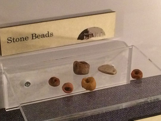
Regional lithic raw material sources. (State Historical Society of North Dakota)

Obsidian forms during volcanic eruptions when lava flows supercool upon contact with air or water, creating volcanic glass. Each volcanic flow has a distinct geologic and chemical signature, and the chemical composition of the obsidian formed from these flows is uniform throughout the source. Obsidian is composed mainly of silica (which gives it its glass-like appearance), but also contains trace elements such as zirconium, niobium, iron, and manganese. The ratios of these trace elements differ between obsidian sources, distinguishing them from each other on an elemental scale. Archaeologists specializing in geochemical techniques use instruments to analyze geological samples and determine a trace element profile for that source. Think of a trace element profile as a kind of fingerprint—although obsidian sources may be similar, no two are exactly alike. Once a geochemist has a fingerprint of the geologic source, it can be compared with artifacts made from obsidian. One of the most common instruments used to assess trace element composition is an energy dispersive x-ray fluorescence spectrometer (EDXRF). This analysis is non-destructive, which makes it especially useful for testing museum specimens.

Obsidian artifacts

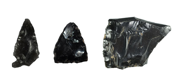
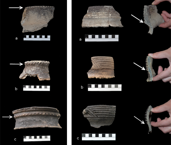
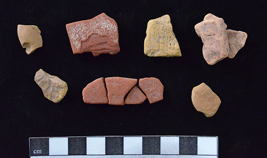
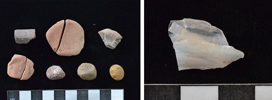
Obsidian artifacts sent for sourcing (left to right: projectile point from Beadmaker; biface from Huff; biface from Shermer). (State Historical Society of North Dakota)

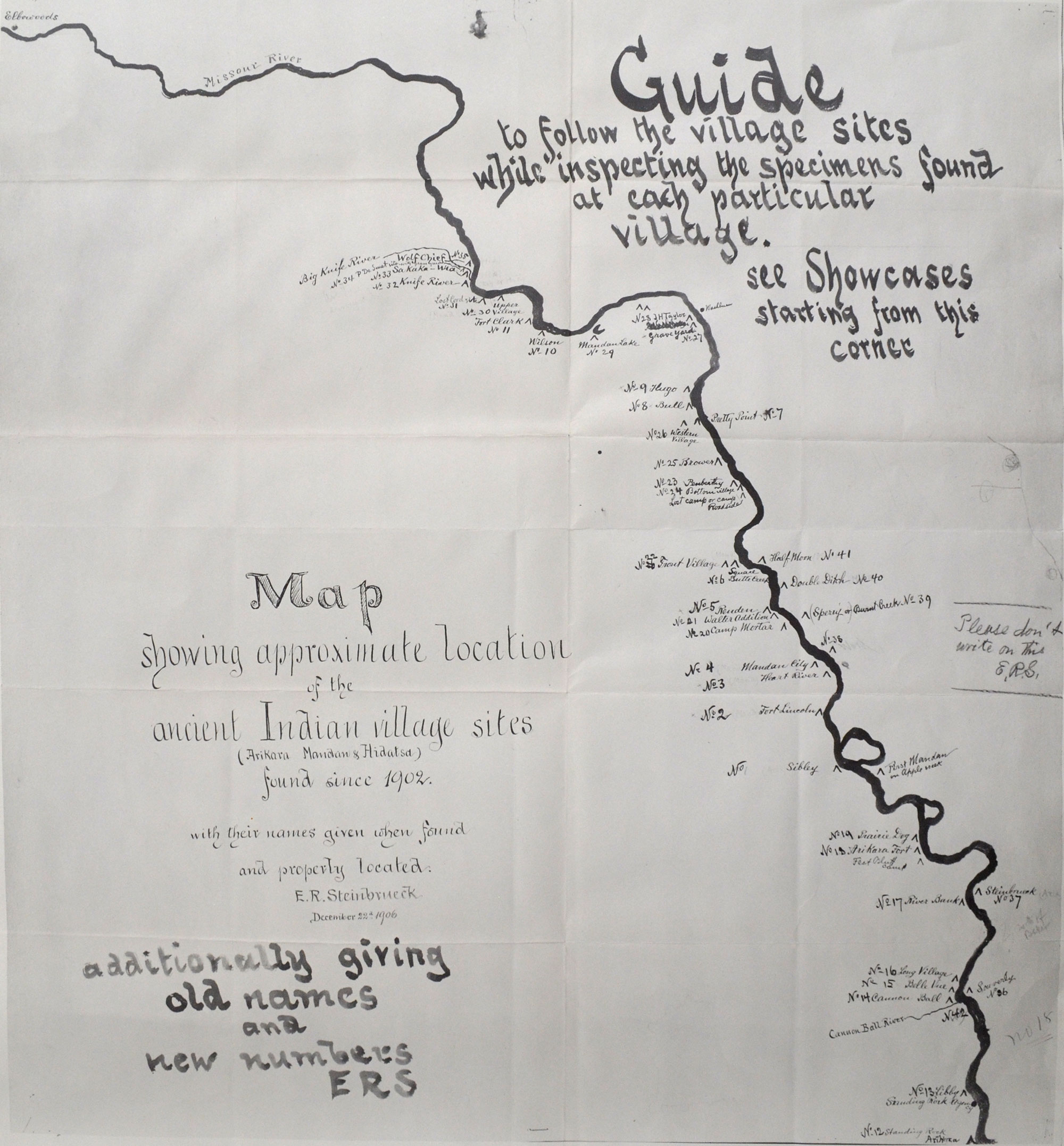
Previous research has shown that North Dakota knappers used obsidian from three main sources in the Yellowstone region: Obsidian Cliff (Wyoming), Bear Gulch (Idaho), and Malad (Idaho)1. This earlier study did not include artifacts from Mandan villages, and we were curious about trade patterns at these sites. The Mandans were key players in an expansive Northern Plains trade network during the Plains Village period, and certain villages may have controlled access to obsidian materials. Obsidian tools and flakes were selected from six Mandan villages and one Mandan campsite that date between AD 1300 and AD 1750. These 76 samples were analyzed by Richard Hughes, Ph.D., at the Geochemical Research Laboratory in Portola Valley, California.

Wyoming obsidian sources

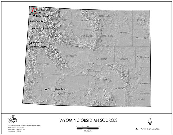
Wyoming obsidian sources (courtesy Northwest Research Obsidian Studies Laboratory, www.obsidianlab.com)

Idaho obsidian sources

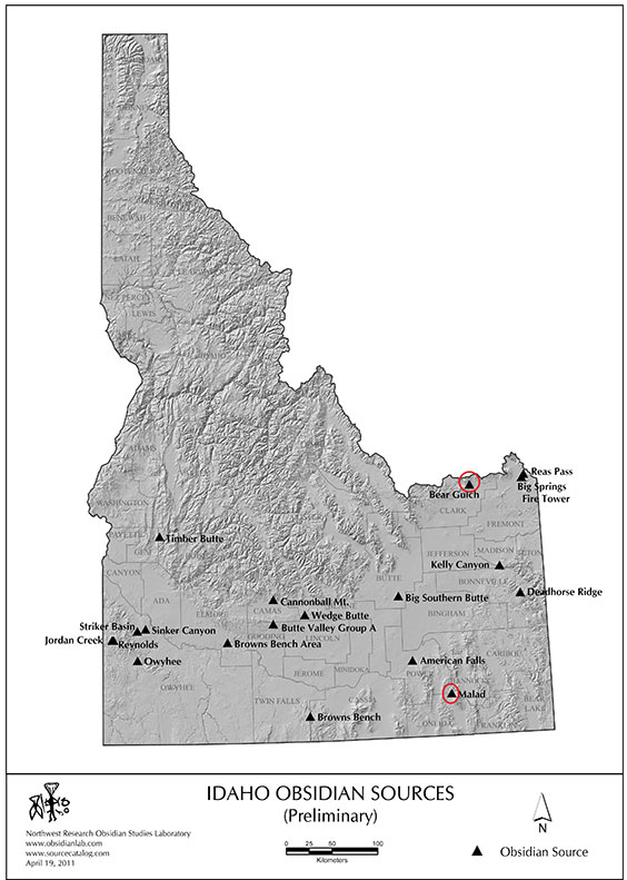
Idaho obsidian sources (courtesy Northwest Research Obsidian Studies Laboratory, www.obsidianlab.com)

Using EDXRF, Dr. Hughes concluded the obsidian artifacts from the Mandan sites came from the Obsidian Cliff and Bear Gulch sources. No artifacts were sourced to Malad. All sites but one had a combination of Obsidian Cliff and Bear Gulch artifacts, although in differing frequencies. The outlier was Huff, but only one artifact was submitted, and this was sourced to Obsidian Cliff.

What does this mean for patterns of exchange in the Mandan world? While this is a pilot study—that is, the first step of a larger project—we can hypothesize that use of Obsidian Cliff versus Bear Gulch materials at Mandan sites was not controlled by certain Mandan villages. Instead, obsidian imports into this region of North Dakota were more likely driven by the hunter-gatherers that controlled access to obsidian outcrops in the Yellowstone area. An expanded sample of Mandan obsidian artifacts will help refine our understanding of regional trade networks.


1 Baugh, Timothy G. and Fred W. Nelson (1988) Archaeological Obsidian Recovered from Selected North Dakota Sites and Its Relationship to Changing Exchange Systems in the Plains. Journal of the North Dakota Archaeological Association 3:74-94.

A Century of Mapping at Huff Indian Village State Historic Site: How Archaeology Changes Over Time

Archaeologists have a solid understanding of Mandan lifeways at Huff Indian Village State Historic Site, primarily as a result of extensive excavations in 1960 as part of the Smithsonian Institution River Basin Surveys1 and additional geophysical and archaeological testing in 19992. But Huff Village was known to archaeologists prior to this time—in fact, it was first recorded as early as 1904 by Ernst R. Steinbrueck, who worked as a field officer for the State Historical Society. Under the direction of Orin G. Libby, Steinbrueck created a list of sites and produced location maps for villages along the Missouri River. One such map in the archaeology collections is dated December 22, 1906, and titled “Map showing approximate location of the ancient Indian village sites found since 1902” (Figure 1). Some familiar sites appear on this map. On the east side of the river, Double Ditch (No. 40) is visible. Fort Lincoln (No. 2) can be seen on the west side of the river. What we now call “Huff Village” was known by Steinbrueck and his contemporaries as “Arikara Fort,” and is No. 19 on this map.

Map of Missouri River villages - 1906

E.R. Steinbrueck’s 1906 map of Missouri River villages. (State Historical Society of North Dakota, Archaeology and Historic Preservation Division flat files)

Archaeological knowledge changes over time, and in Steinbrueck’s era, archaeologists thought they had identified an Arikara village enclosed by a fortification wall—hence, Arikara Fort. We’ve known for some time that Huff is in fact a Mandan village, based on ceramics and other artifacts. But that isn’t the only thing that has changed: in 1908, Steinbrueck drew a map of “Arikara Fort” with 182 lodges inside the fortification ditch (Figure 2). Eleven of the houses are rectangular, and the rest are circular. Compare that map with one drawn by archaeologist W. Raymond Wood in 1960 (Figure 3). This map shows 102 houses, 101 of which are rectangular. On Wood’s map, there is only one square lodge with rounded corners, which could be interpreted as a circular lodge.

Map of Arikara Fort

E.R. Steinbrueck’s 1908 map of “Arikara Fort.” (State Historical Society of North Dakota, Archaeology and Historic Preservation Division flat files)

Map of Huff Village

W. Raymond Wood’s 1960 map of Huff Village. (Wood 1967: Map 4)

Wood assembled published and unpublished maps of Huff Village to show the variations in village interpretation over time (Figure 4). We now know that among the Mandan, long-rectangular houses preceded round earthlodges. This is evident at Huff, which dates to about AD 1450: the single round lodge shows that people were experimenting with a new form of housing.

Comparative maps of Huff Village

W. Raymond Wood’s comparative maps of Huff Village, 1905-1960. (Wood 1967: Map 3)

So why did early maps of Huff Village show circular lodges? Wood (1967:28) offers the following explanation:

This resume of the history of Huff cartography is particularly interesting in revealing the extent to which preconceptions effect the perception of field data. The first long-rectangular house excavated in North Dakota was House 5 at Huff, dug by Thad. Hecker in 1938-39. Prior to that time there was no hint in the literature of villages composed solely of long-rectangular houses. The local historic earth lodges were circular and, despite the large number of sites available of long-rectangular houses, field workers persisted in “seeing” the circular houses they expected to find.

In other words, people were familiar with the round earthlodges used historically by Mandan Indians and anticipated finding evidence of similar lodges in the archaeological record. This is a form of confirmation bias, or finding results that uphold your existing beliefs. It’s something that archaeologists—and all scientists—must be aware of in their research. The variation in the number of recorded lodges suggests some of the earliest drawings were impressionistic and not created using survey equipment. Improvement in mapping technology has allowed for extensive geophysical survey (including magnetic and electrical resistance surveys) to be performed at Huff. This helps archaeologists “see” underground and pinpoint individual features for excavation (Figure 5).

Comparison of house plans

Comparison of (a) house plans drafted by Wood (1967) and (b) houses identified by magnetic survey. (Ahler and Kvamme 2000: Figure 18)

So what comes next in this second century of research at Huff? Researchers from the University of Texas at Dallas Geospatial Analytics and Innovative Applications Research Lab are using drone technology to take aerial photographs that can be georeferenced down to a centimeter. This precise form of mapping will improve our perception of microtopography (or small landscape features), as well as provide state-of-the-art figures for publication and outreach. There’s still much to learn from this exceptionally-preserved site. Take some time to visit Huff this fall, and observe the lodges and fortification ditch yourself.


1 Wood, W. Raymond. 1967. An Interpretation of Mandan Culture History. River Basin Surveys Papers 39. Smithsonian Institution, Bureau of American Ethnology Bulletin 198. Washington, D.C.
2 Ahler, Stanley A., and Kenneth L. Kvamme. 2000. New Geophysical Research and Archaeological Investigations at Huff Village State Historic Site (32MO11), Morton County, North Dakota. Research Contribution 26. PaleoCultural Research Group, Flagstaff, AZ. Submitted to the State Historical Society of North Dakota, Bismarck.

Revisiting Old Collections: Native American Pottery from the Jennie Graner Site

The most interesting discoveries an archaeologist can make occasionally involve artifacts collected decades earlier. I happened upon such a discovery while preparing to carry out fieldwork on behalf of a federal agency. While conducting background research, I learned the State Historical Society houses a small ceramic assemblage originally collected in 1938. These 73 ceramic rims and body sherds represent the bulk of artifacts collected from site 32MO12, or the Jennie Graner site. My search for information about the pottery itself, as well as the history of previous research at the site, led me on a winding path through archival records and the handwritten notes of Thaddeus C. Hecker, a former archaeologist with the State Historical Society.

Hecker is probably most well-known to archaeologists who have read his and George Will’s inventory of Plains Village sites along the Missouri River in North Dakota1. Previous to this 1944 publication, Hecker and other archaeologists working for the state identified a Plains Village site on the west bank of the Missouri River near the town of Huff. At that time, the site was on the property of Jennie Graner and was named after her. Although Hecker collected pottery in 1938, there is no indication that he conducted excavations at the site:

The first time I visited this site I found a lodge floor in the cut-bank where an unusual amount of pottery of various designs in decoration had weathered out. The rim-sherds were rather thick and all decorations were punch incised; also a number of designs in decoration were different than I had seen before…The pottery of this site is undoubtedly of Mandan Culture.2

Thaddeus C. Hecker

Thaddeus C. Hecker, 1938. (State Historical Society of North Dakota C3717-00001)

Although Jennie Graner is considered an earthlodge village site, no remnants of earthlodges or middens are visible on the surface like they are at other Mandan sites such as Huff and Double Ditch villages. There is also no evidence of a palisade or ditch at Jennie Graner. Perhaps the Mandans who lived there did not need a protective wall around their village—or perhaps evidence of lodges and ditches have been obliterated by farming and construction activities. Even in 1944, Will and Hecker reported that the site was eroding into the river and was severely impacted by modern earthmoving activities.

Aerial view of Huff Indian Village State Historic Site

Aerial view of Huff Village State Historic Site, located south of the Jennie Graner site. Note earthlodge depressions and fortification ditch. (State Historical Society of North Dakota 00630-04)

The age of the Jennie Graner site is unknown, but Will and Hecker referred to it as “Archaic Mandan,” or what archaeologists now call the Extended Middle Missouri. The latest regional chronology of village sites gives the Extended Middle Missouri an age range of AD 1200-14003. Ceramic analysis suggests Jennie Graner would fall toward the end of this age range, possibly in the late 1300s or early 1400s. Pottery styles and designs changed through time, but these changes did not happen overnight. New styles were tested and incorporated slowly, resulting in many ceramic forms occurring contemporaneously. Four types of ceramic “ware” have been identified from this site. The earliest wares are Riggs ware and Fort Yates ware. These are followed chronologically by Stanton ware and Sanger ware, respectively4. Riggs and Stanton wares have straight rims, while Fort Yates and Sanger wares have S-rims. The presence of transitional forms between Riggs and Stanton, and between Fort Yates and Sanger, suggests potters at Jennie Graner may have been experimenting with vessel construction and decoration.

Ware rim

Left: (a) Riggs ware rim. Note the tall rim and location of tool impressions directly on the lip; (b) Transitional form between Riggs and Stanton wares. Rim height is shorter, and tool impressions appear lower on the rim; (c) Stanton ware rim. Addition of fillet with tool impressions well below the lip of the rim. (All specimens SHSND 7123)
Right: (a) Fort Yates ware rim. The juncture of the rim and neck is angular; (b) Transitional form between Fort Yates and Sanger wares. The juncture is less angular and becoming more curved; (c) Sanger ware rim. The juncture between the rim and neck is curved. (All specimens SHSND 7123)

Jennie Graner is on land managed by the US Army Corps of Engineers. Recent testing of the site by State Historical Society archaeologists will tell us more about the size, age, and occupation length of the village, as well as whether it qualifies to be nominated to the National Register of Historic Places. We also hope to learn its relationship to the nearby Huff Indian Village State Historic Site and other Missouri River Mandan villages.


1 Will, George F. and Thad C. Hecker. 1944. The Upper Missouri River Valley Aboriginal Culture in North Dakota. North Dakota Historical Quarterly, vol. 11 (1-2), pp. 5-126.
2 Hecker, Thad C. 1938. Morton County Archeology. Manuscript on file at the State Historical Society of North Dakota, Archaeology & Historic Preservation Division.
3 Johnson, Craig M. 2007. A Chronology of Middle Missouri Plains Village Sites. Contributions to Anthropology 47. Smithsonian Institution Scholarly Press, Washington, D.C.
4 Ahler, Stanley A. 2001. Analysis of Curated Plains Village Artifact Collections from the Heart, Knife, and Cannonball Regions, North Dakota. Research Contribution No. 42, PaleoCultural Research Group, Flagstaff, AZ. Submitted to the State Historical Society of North Dakota.

Archaeology in the Digital Age: 3D Artifact Imaging

Sometimes the methods archaeologists use to preserve artifacts stand in stark contrast to the objects themselves. Using modern three-dimensional (3D) scanning technology to create digital models of ancient stone technology is one of those instances. This type of image capture is becoming increasingly popular in archaeology and museum labs for its relative ease of use and the affordability of commercially available scanners, not to mention the highly detailed models produced. We purchased a 3D scanner in 2011 to aid our staff and researchers in artifact analysis, and to provide the public with better access to our collections.

NextEngine Scanner

NextEngine Scanner ready to create a 3D model of a stone knife in the Archaeology and Historic Preservation division of the North Dakota Heritage Center & State Museum.

In addition to creating a digital record of an object, archaeologists and others working in cultural heritage fields can use the models to take high-resolution measurements, create exact replicas using a 3D printer, and share high-precision digital data with colleagues.

One of the benefits of digitizing artifact collections is the ability to share those objects in a way that encourages the public to interact with the past. An artifact’s minute features are captured in greater detail with a 3D scanner than with traditional digital photography. There are about 12 million objects in the state archaeology collections. Most of these will not be on display in the galleries, but with 3D scanning, anyone with an internet connection can get a behind-the-scenes look at these collections. From the comfort of your home, you can appreciate the craftsmanship of an artifact that 3D scanning brings to life.

3D scan of stone knife

Screen grab of the finished scan in NextEngine StudioScan software prior to uploading the model to Sketchfab.com.

Sketchfab.com is an open source, free hosting site for 3D models. With a mouse, trackpad, or finger, the user can move and turn the object, zoom in and out, and copy the link to share with others. A user can also “Like” the model and leave a comment. The object can even be observed in virtual reality if the user has VR headset.

Sketchfab.com directions

Navigation directions for the Sketchfab.com viewing window.

This artifact is a stone knife from Griggs County in eastern North Dakota; it was donated by a private collector. The knife was hafted, meaning it was fit into a handle that could give its user better leverage while cutting. We don’t know how old the knife is, but we do know it’s still usable and has only a small break on the base. Why do you think someone left it behind? Was it lost?


Like photographs and videos, 3D scanning is a digital medium that helps us engage with the past. Unlike those types of media, 3D models invite you to interact with an object in an almost tangible manner. So go ahead—give it a spin and feel like you’re holding history in your hand.

The Beadmaker Archaeological Site Part II: Stone Bead Production

This is the second blog in a series on the Beadmaker archaeological site, a Mandan campsite dating to AD 1600-1650 near the Heart River. I previously wrote a brief background on Beadmaker, which you can find here (blog.statemuseum.nd.gov/blog/beadmaker).

Ornamental stone bead production is a fascinating aspect of life at Beadmaker. More than 120 beads in various stages of manufacture have been recovered from the site. Like other types of technology, beads were manufactured in a set of successive stages: (1) obtaining raw material, (2) initial shaping, (3) preparation for drilling and actual drilling, (4) shaping/smoothing after drilling, and (5) final shaping/rounding of bead. Mandan people might not have recognized these as distinct phases, but this type of classification helps archaeologists understand how beads were produced and the thought process behind their manufacture. At Beadmaker, stone beads come in both disc and cylindrical forms.

Soft siltstone

Stage 1: Obtaining raw material. These are pieces of soft siltstone or mudstone.

Beads were made on soft siltstones found locally in a variety of colors. It was fairly easy to carve or grind these stones. Think about scratching a piece of scoria road rock with your fingernail, and you’ll get a sense of how “soft” these rocks are.

Initial shaping

Stage 2: Initial shaping to create a bead blank. Notice the trimmed edges and placement of “pilot holes.”

After choosing pieces of siltstone for raw material, the stoneworkers would shape the rock to create a “blank,” or a piece that begins to resemble the eventual shape of the bead. Two of these rocks show the beginning of drill marks, suggesting the initial blank shape may have been achieved or a type of pilot hole was started to give the beadmaker a sense of the center. A beadmaker had to be careful during grinding and plan ahead to the final product, because once material was removed, it could not be put back again. The softness of the material probably allowed people to modify their plans as they worked, in case they made a mistake.

Preparation for drilling and flake tool

Left - Stage 3: Preparation for drilling. These bead blanks have been rounded and smoothed.
Right - A very small (~1 inch) flake tool used to drill beads. This could be held between the thumb and forefinger and twisted repeatedly.

After a beadmaker attained the desired shape, beads were prepared for drilling and drilled using a small flake tool. If the bead blank broke during this process, it was either reshaped or discarded. Drilling was probably the most difficult step of manufacture; even if a blank was successfully drilled, the bead itself became more fragile with the addition of a hole. This could make further shaping after drilling risky, as the bead could snap in half. This is seen fairly regularly in the next stage of production.

Broken beads and two pieces fitting together

Left - Stage 4: Shaping and smoothing after drilling. These beads broke either during or shortly after drilling. Note the ridged drill marks on the specimen in the top row, second from left.
Right - Two pieces of a tubular bead that refit. The center and outside are very smooth, suggesting this bead may have been finished but then accidentally stepped on or broken.

Most of these beads show drill holes that pass all the way through the center, but the beads then snapped or cracked. The two tubular pieces in the image above actually fit together, and may represent a finished bead that was accidentally trampled or crushed when people walked around their camp.

Finished beads

Stage 5: Finished beads. These are only about 1 cm (0.4 inches) in diameter.

Finished beads were probably prized objects used for personal adornment and unlikely to be purposefully left behind at a site. Three complete, finished beads were recovered from Beadmaker, along with broken finished beads They were probably shaped using sandstone or clinker abraders.

So why are there so many stone beads at Beadmaker? If the interpretation of a hunting camp is correct, it’s plausible that the men had downtime while waiting for scouts to return with a report on bison location and movement. Perhaps older men used this time to teach younger men how to craft these ornamental objects. With a seemingly endless supply of raw material on hand, the novice beadmakers could try their hand at bead manufacture without worrying about wasting stone.

Stone beads on display

Stone beads from On-A-Slant Village, Fort Abraham Lincoln State Park.

Stone beads appear at other Mandan sites, including Huff, Bagnell, and On-a-Slant Villages, indicating these were probably an important feature of decoration and group identification prior to the arrival of glass trade beads.