Field Trips: Setting the Hook for Life-long Engagement
I have always been a storyteller. My notebooks from school contained bits of stories or skits, things I found amusing, or ideas that would not leave my head until I had them down on paper. I still carry a notebook for that reason. My love of storytelling was a part of what made me an engaging teacher. Like a good story, I had to hook my audience. Right now, my focus is on field trips and how we can create a memorable experience. Students are not going to remember all of the facts that you try to cram into a visit, but they will remember an activity or experience they can’t do anywhere else. Some sites come with a built-in hook. The Ronald Reagan Minuteman Missile State Historic Site is a great example. Where else can you go 50 feet underground and see the keys that could start a nuclear apocalypse? That is my hook. Once hooked, we can dive deeper into the history, stories, and people. But just like fishing, you often need more than one lure, and that is what our sites are currently developing.
Several of our sites are currently working on revamping what happens on a field trip. We want to move past the formula of watch this video, follow these rules, and complete this worksheet disguised as a scavenger hunt. These sites are developing hands-on activities and programs to engage students. Up at Pembina, they are working on creating a game that simulates the fur trade. It is still in development, but once completed, it should make for a great learning experience. The Ronald Reagan Minuteman Missile State Historic Site is developing new educational days where students can learn about rockets and UAVs (drones).
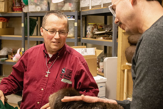
Site Supervisor Jeff Blanchard shows off some of the props collected for Pembina State Museum's fur trading activity to Sites Manager Rob Hanna.
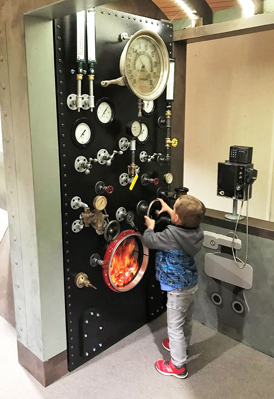
Programs are not the only solution. Take all of the new changes coming to the Stutsman County Courthouse. A hands-on exhibit that teaches about civics and the role of elected government officials people tend to vote for while not know what the position even does is a fantastic learning tool I wished existed when I was teaching government. This highly original new exhibit has the potential to reach kids outside of a historical context. We added LED lighting to show off the marvelous mechanisms of these magnificent machines and inspire the mechanically minded student. The history may not hook them, but the engineering might. I have the pleasure of touching up the paint on the courthouse's new 1908 Burrows Adding machine. I am not going to lie. I could have finished it in a day, but I am taking my time so that it can spend more time on my desk. It is that cool.
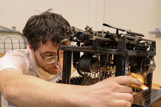
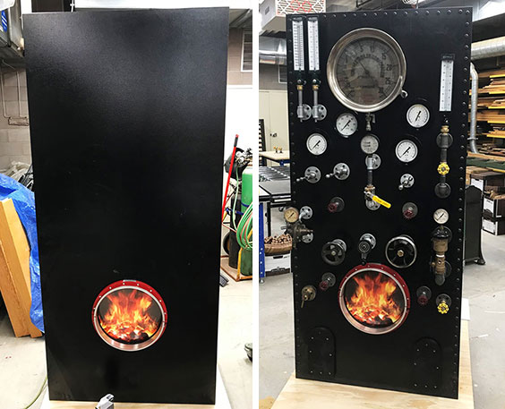
Art fabricator Jonah Eslinger designed and installed LEDs into a typewriter for the new civics exhibit at Stutsman County Courthouse.
But not every school is going to be able to travel to all of our sites. The Chateau de Mores is most likely never going to give a field trip to students in Fargo. We need to address that. For the past few months, we have been working on developing a new program we are calling Ask-an-Expert. Using Skype, our fantastic content experts at the sites will be able to engage with classes across the state. The idea is simple. Our sites have created a list of topics that connect their site themes with the content covered in North Dakota Studies. Teachers can introduce the content to their students, have them think up questions, and then as a class call-in and have students ask their questions to experts. It is still in development, but we have run a few tests, and we were excited to see students engaging in historical thinking. In the next month or so, we hope to have some more information for teachers on how they can take part in testing this program out with us. We are excited by the potential and the possibility of expanding our offering and working towards adding full-fledged virtual field trips of sites.
Field trips allow students to see the concepts that they are learning in school in action. For some students, it may be the first time that they experience a museum, historic site, science center, or wiring closet. (Yes, I took several field trips to check out wiring closets.) We have an excellent opportunity to create lifelong museum-goers. All we need to dangle the hook and see what bites.