The Social Side of Archaeology
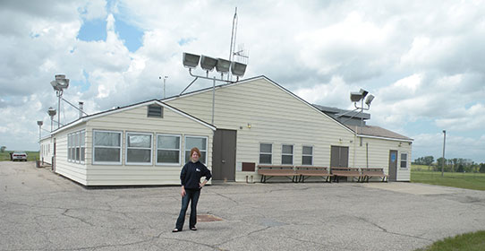
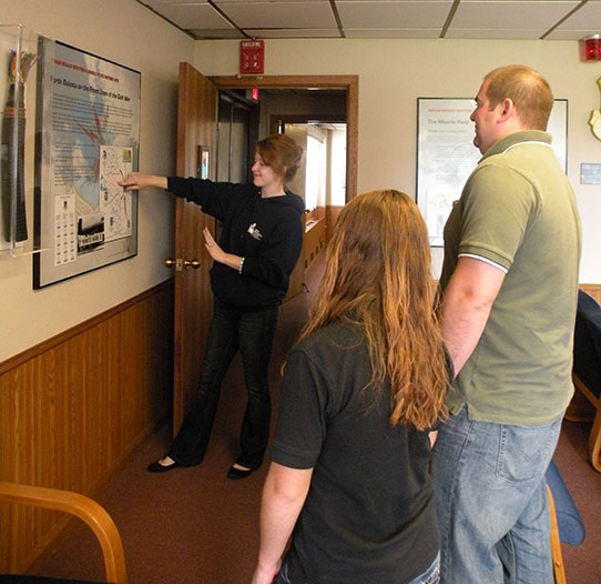
To illustrate a short video segment about archaeological collections work, a co-worker recently asked me for pictures of fieldwork I did during graduate school. Only after I sent those pictures did it occur to me that they probably needed a bit more explanation. That is because most of them are not the pictures you would typically associate with fieldwork. There are none of me working in an excavation unit, or walking transects on a survey, or looking at pottery through a microscope. I mean, I did all of those things in grad school. But most of these pics are of me talking to people. And it was the most exciting fieldwork I have ever done.
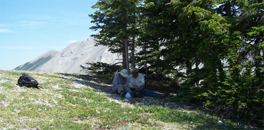
Viewing a map with an elk hunter in the Rockies (M. Zedeno)
Many archaeologists develop a particular expertise in a specific material class. Some are ceramicists, some are malacologists (shell), some are experts in faunal remains (animal bones) – the list goes on. And we need them all! But I had a transformative field school experience in Arizona back in 2003 when I was just getting started in archaeology that led me down a slightly different path. We learned all the usual things you learn in field school – excavation techniques, survey, mapping, lab analysis, etc. But the focus of the field school was on tribal collaboration and ethical archaeology. We had guest speakers representing different tribes in the area, who shared their views on the past, the importance of oral tradition as a historical resource, and their perspectives on the sites and objects created and used by their ancestors. We also heard from archaeologists who had partnered with Native American tribes to develop research projects that increased archaeological knowledge, but also addressed topics that were meaningful or important to that community. I came away with the feeling that archaeology should have as much to do with living people in the present (also known as descendant communities) as it does with how their ancestors lived in the past. I was still interested in objects, of course. But I was most interested in how descendant communities see and think about those objects.
So what about those pictures of me talking to people? They were from projects run by the Bureau of Applied Research in Anthropology at the University of Arizona. They focus on interviewing tribal elders and cultural specialists in the Northern Plains about their knowledge of specific resources – plants, animals, landscapes, and archaeological sites. For example, rather than do a walking survey by transects, we did survey on horseback with Blackfeet elders who showed us historic elk hunting camps. They gave us information about how they were set up and who used them – things we never would have known had we mapped them alone. And here is some unsolicited advice: do not ever let your first horseback riding experience be several days on the edge of dizzying cliffs on the Continental Divide in Montana’s grizzly bear country with your dissertation advisor, who you were hoping would see you as a confident, adventurous, and roll-with-the-punches kind of research assistant.
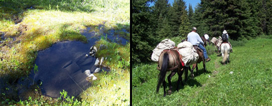
Left: The remains of a barrel feature found at a historic elk hunting camp in Montana (M. Zedeno)
Right: Archaeological survey on horseback (M. Zedeno)
In addition to looking at plants under a microscope, we interviewed Mandan and Hidatsa elders about the cultural significance and traditional uses of particular plants. This allowed us to provide a report to the National Park Service to help them come up with resource management plans that are sensitive to the plant-related needs and beliefs of native communities. For a project about eagle trapping, we did not look for eagle bones in faunal assemblages. Instead, we visited eagle trapping sites with elders who still hold eagle trapping rights, and learned about why certain types of objects and features are found together. We also learned how those sites can be more respectfully managed.
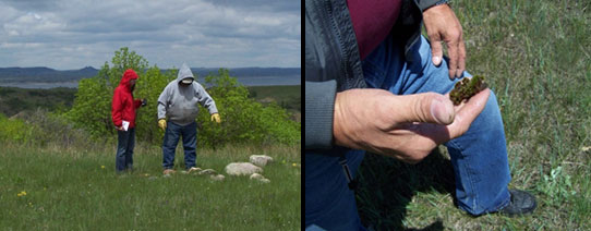
Working with tribal consultants from Fort Berthold on the University of Arizona’s Missouri River ethnobotany project (M. Zedeno)
So while I love objects as much as the next archaeologist, a good part of my archaeological training has actually been in ethnography and interviewing. As all of my friends were creating GIS models or comparing radiocarbon dates, this used to find me mired in an angsty anthropological identity crisis (I’m an archaeologist! No, I’m a cultural anthropologist! I’m neither! I’m both! I’m an imposter! Ahh!). But I am over that. And to be frank, I am pretty darn excited about what I do these days.
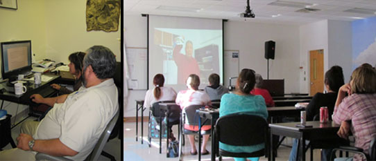
Left: University of Arizona researcher Dr. Maria Nieves Zedeno and the Tribal Historian of the Mandan, Hidatsa, and Arikara Nation, Calvin Grinnell, revise a report at the Three Affiliated Tribes Museum (W. Murray)
Right: A viewing of the SHSND-produced documentary, People of the Upper Missouri: The Mandans at Fort Berthold Community College in New Town, ND (W. Murray)
There are lots of things to do at the SHSND that are right in line with this – whether we were working on developing the Early People’s exhibit, producing the Mandan documentary, interpreting our historic sites, consulting with tribes on the significance of particular objects, or conducting oral history interviews. Somehow they all involve the links between archaeology (the tangible stuff of the past) and ethnography (people’s worldviews, stories, practices, and traditions).
For example, we are currently collaborating with the Arikara Cultural Center to interview people about life in the bottomland communities (Elbowoods, Nishu, etc.) before the construction of the Garrison Dam in the 1950s. Now that these sites lie beneath the waters of Lake Sakakawea, the physical sites that would normally be a part of the archaeological record are gone. But documenting the collective memories of what it was like to live there are vitally important to the Fort Berthold community.
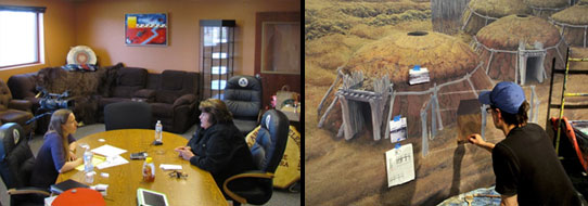
Left: Interviewing Dorreen YellowBird at the Arikara Cultural Center in White Shield, North Dakota about her memories of living in Elbowoods before the construction of the Garrison Dam (K.T. Kroupa)
Right: Artist Rob Evans worked with SHSND archaeology staff to create a depiction of the Double Ditch Indian Village as it would have appeared around AD 1550. Much of the detail derives from archaeological excavations and ethnographic records. At the request of Alyce Spotted Bear, we also included audio components throughout the exhibit (including this cyclorama) that allows visitors to hear people singing and speaking native languages.
When I moved here, I was afraid that a job in collections would be less about people, and more about things. Luckily, that is not even close to how it has worked out. Working in the Archaeology and Historic Preservation Division of the SHSND on these and other projects has only cemented my belief that the present – native voices and perspectives on the past - is not peripheral to “real” archaeological work. It is, in fact, an integral part of it.


